 |
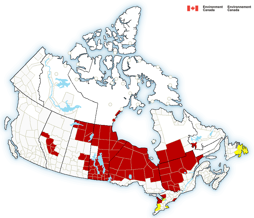
| Extreme cold warnings stretch from Manitoba to Labrador (red shading). Those warnings may be extended to southern Ontario and Quebec later today. Snow squall warnings are in effect around the southern Great Lakes. |
Winds will lessen on Sunday, but it will remain cold with early morning lows of -25C (-13F) in Montreal, much colder away from the city. Sunday will be sunny but cold, with a high temperature no better than -15C (5F).
Potential Snowstorm
Looking ahead to next week, temperatures will moderate to near-normal, but there is a chance of snow by Tuesday. Low pressure is forecast to deepen and move from the mid-Mississippi Valley to New England by Wednesday. Depending on the exact track, Montreal may receive in excess of 15cm of snow. Computer forecast models have presented different scenarios ranging from a total miss to rain and temperatures above freezing. I will attempt to fine-tune the forecast over the weekend with updates daily.
No comments:
Post a Comment