You are looking at a much warmer Tuesday morning than when we went to sleep across eastern Ontario and southwest Quebec. Temperatures here in Montreal and the St. Lawrence Valley have been increasing through the overnight hours from a low of -12C at 2am here on L'Ile Perrot, to where they sit now at 0C across the region including Ottawa and Montreal. Gusty southwest winds are causing some blowing and drifting snow especially on off island highways, so you need to be aware of that. Otherwise it looks like a windy and mild January "thaw" day with just a passing snowflake or two. The mild air is in place right into the upcoming weekend with highs possibly reaching 6 or 7C (45F) by Saturday. There will be a trio of low pressure areas that could bring a mix of rain or freezing rain on Friday and then showers by Sunday. The cold air will make a return by early next week, and we could be looking at the deep freeze into February. But for the short term enjoy a wee respite from what has been a snowy and cold couple of weeks here in Montreal.
Ice Storm of 1998
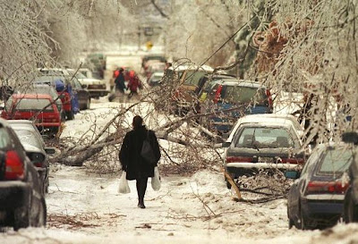 |
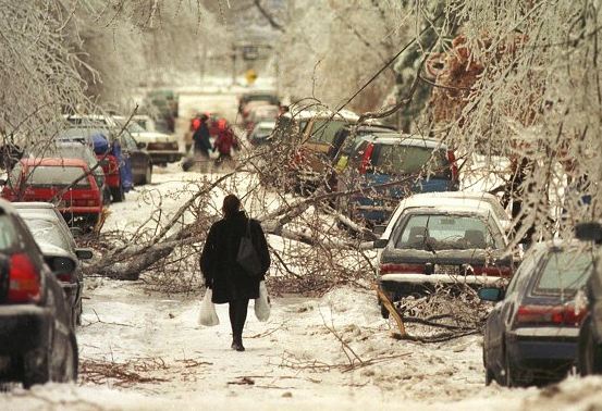
| A Montreal street lies blocked by a maze of trees and wires during the Ice Storm of 1998. (Montreal Gazette). |
Today is the 15th anniversary of the worst weather disaster in Montreal history, The Ice Storm of 1998. I will have more to say on that in another blog entry along with some pictures my family took from our Verdun home. In an ironic twist, after having spent the first 30 years of my life in Montreal, 20 of them observing and covering weather, I had just moved to Saskatchewan when the storm hit, and missed the entire event. The storm claimed dozens of lives and left the region without power for up to 1 month. Damage was in the billions of dollars including almost all of Hydro Quebec's power grid here in the south. The storm stretched from Kingston and Ottawa to Montreal and south into extreme northern Vermont and especially New York.
No comments:
Post a Comment