This morning we are seeing more convection developing along the cold front just west of our region. Look for a few showers to accompany the front as it crosses Montreal. We may even have a rumble of thunder, as that was quite common in Ontario last night. The main energy of the low pressure will swing through Quebec later today with some light snow developing tonight along with blowing snow and lasting into Sunday. Up to 5cm may fall over Quebec. Winds will be the big story with this storm. Warnings are in effect across the area from Quebec City all the way to Windsor, Ontario and south into northern New York.
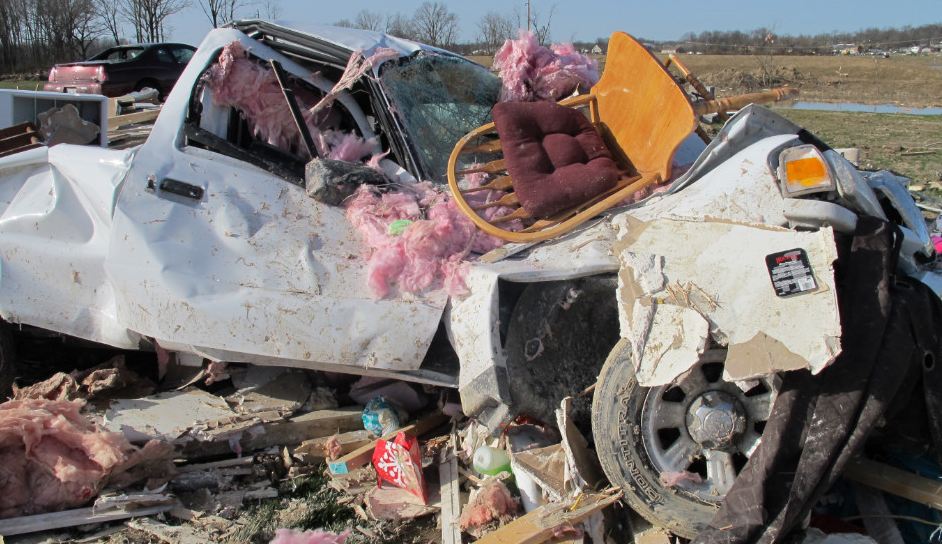 |
| Unbelievable damage from Harrisburg, Illinois on Friday (CNN.com) |
Strong low pressure is moving east from the Great Lakes this morning. What more can you say about this deepening area of low pressure, it has been deadly, catastrophic and unprecedented for early March. Nearly 100 tornadoes were spawned yesterday from Ohio to Alabama. Especially hard hit were Illinois, Indiana and Kentucky. Winds of up to 180mph accompanied some of the storms. One twister in Harrisburg, Illinois virtually levelled the town killing 6. The death toll is sitting at 31 this morning, and close to 50 from the week of storms. The number of tornadoes yesterday exceeds the normal monthly total in the US for March. The images of destruction are hard to understand and grasp and I get it, I understand weather, and yet the severity of these storms even surprises me.
No comments:
Post a Comment